|
Other Important Tips for RAGBRAI Orientation
(Besides downloading, saving, and printing your
PBV Rider Maps and RWGPS Files)
Find and Follow Someone with RWGPS: We hope there will be a lot of good citizens out there this year, tech savvy folks who will lead others to camp.
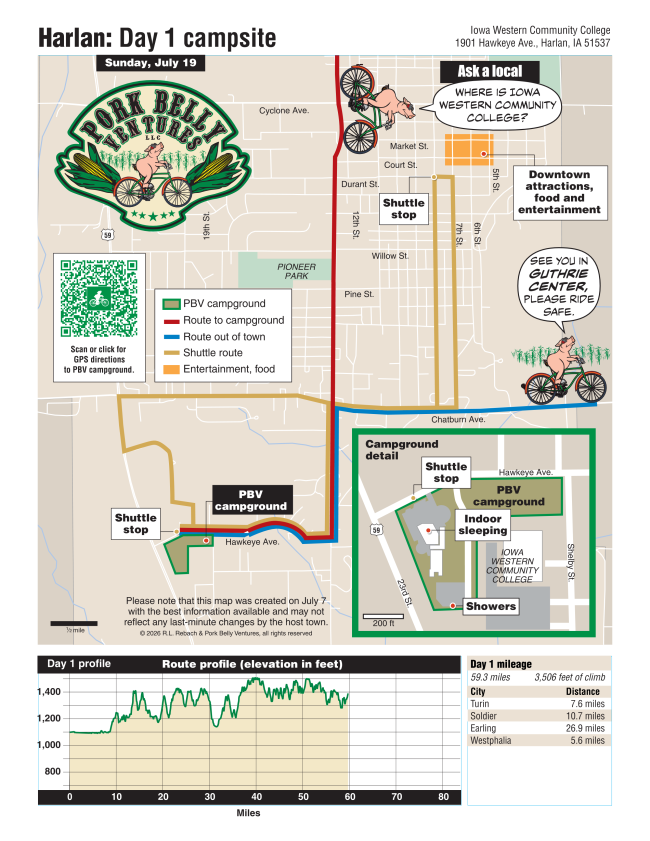
Our Maps: At your last stop of the day, pull up a photo of our map (or carry a copy). Remember your first turn upon entering the overnight town. You may have to pull over a couple times for safety, but your map will guide you to camp. Shortly, possibly as soon as this evening, the app will be updated with the new maps!
Our Locations Card: Everyone who spends the week with PBV receives the durable locations card, with a zip-tie. You may wish to zip-tie your card to your handlebars or top tube. The locations card provides you with the name and address of every campsite, and a suggestion that you "Ask a Local: Where is the water tower?" The locations card is our old-fashioned, lowest-tech tool for finding Pork Camp, but you may find it useful in a pinch!
The RAGBRAI Route Maps: With mileage and elevation for each day, download the RAGBRAI Route Maps so you know how far until your next ear of sweet corn.
The Overnight Town Maps: If you want to find out how far it is from Pork Camp to Downtown, or where the swimming pool is, or where the shuttle route goes - download the overnight town maps on RAGBRAI's website, linked below. We'll also have a copy at our Front Desk.
Both the RAGBRAI Route Maps (plus Gravel and Loop Routes) and the Overnight Town Maps can be found on RAGBRAI's website, by clicking on each day and then scrolling down to the map you're looking for.
|